Backpacking Tonquin Valley takes hikers deep into the heart of untamed and serene wilderness in Jasper National Park. While this route can be done as a very long day hike, turning it into a multi day backpacking trip gives hikers a chance to fully enjoy the pristine alpine waters, towering peaks, and lush meadows that make the Tonquin Valley one of the hidden gems of Jasper. Additionally, the Toqnuin Valley is the world’s second largest dark sky preserve, so the stargazing is phenomenal. This complete guide to backpacking Tonquin Valley in Jasper National Park goes over the transportation logistics of the point-to-point trail, how to secure backcountry permits, and a full trip report of my experience completing the hike.
Overview
- Where: Jasper National Park, Alberta, Canada
- Trailhead: Portal Creek Trailhead | Google Maps
- Distance: 43 km Point-to-Point
- Time Needed: 2-3 Days
- Elevation Gain/Loss: 1075 m
- Maximum Elevation: 2200 m
- Difficulty: Moderate
- Route: Portal Creek – Amethyst Lakes – Cavell Lake
- When to Hike: June – Early October
- Permits Required: Yes
- Pets Allowed: No (Carribou Country)
- Bear Spray Required!

Map of Backpacking Tonquin Valley Trek
Are Permits Required for Backpacking Tonquin Valley?
If camping overnight, backcountry permits are required from Jasper National Park. Parks Canada uses a reservation system for securing permits. Reservations for Jasper National Park open in March for the 2024 season; see here for exact dates. Be prepared to book for your desired dates as soon as the reservations are made available, backpacking Tonquin Valley is one of the most popular multi day treks in Jasper National Park and they can fill up in minutes.

How to get to Tonquin Valley and Taxi Service Information
Backpacking Tonquin Valley is a point-to-point trek, so you either need to have 2 cars at the start and end or use a mountain taxi service, there is no shuttle service. Hitchiking is another option, but the road is not well trafficked, so you could have a long wait; we didn’t see anyone on the drive out.
There are 2 main options for taxi shuttle services to Tonquin Valley: Caribou Cabs and Mountain Express Taxi. We used Mountain Express Taxi; they had excellent customer service and I would definitely use them again. They charged a flat rate of $100 CAD to pick us up at the Cavell Lake Parking Area (where we left our car) and shuttle us to the Portal Creek Trailhead to start the trek.
What’s the best direction to do Tonquin valley?
It really depends! This trail is quite moderate as far as backpacking trails in Canada go. Starting from the Astoria Trailhead gives a more gradual ascent over the first 25 km of the trail, with a final descent to the Portal Trailhead on the last day. I did it the opposite direction starting at Portal the Portal Trailhead because I like to get elevation out of the way at the begining of my hikes when I’m fresh.

When is the best time of year to backpack Tonquin Valley?
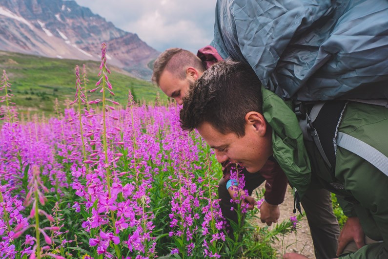
The official season for the Tonquin Valley is end of June to end of September. Late summer (mid-August to mid-September) is ideal to avoid the mosquitoes and black flies. Additionally from mid-July to mid-August is one of the best times to see the wildflowers bloom in Tonquin Valley (This is when we decided to go). In late September to Early October Toqnuin Valley experiences Larch Madness, where several sections of the valley transform into a gorgeous sea of yellow larch trees for about 2 weeks.
What are the best backcountry campsites in Tonquin Valley?
There are seven backcountry campsites in the Tonquin Valley to choose from, and all require advanced permit reservations. I think Maccarib and Amethyst are best campsites for views. Each campsite has the same basic facilities: picnic tables, bear boxes for food storage, and pit toilets. Below is a brief description of each of the campsites:
Backcountry Camgrounds in Tonquin Valley
Portal – Secluded, tucked away in dense woods
Maccarib – Nestled in the tress but with excellent views
Amethyst – Very exposed, very close to Amethyst Lake and has gorgeous views of the Ramparts Mountain Range. About the halfway point of the route
Clitheroe – Dense tree cover with limited views of the Ramparts
Suprise Point – Exposed campground with Nice views of Amethyst Lake and the Ramparts; off the main trail
Switchback – Medium tree cover with some mountain views
Astoria –Secluded, tucked away in dense woods high above Astoria River
Trip Report
After the popular Skyline Trail was booked for the days we were looking to backpack we landed on the Tonquin Valley not knowing too much what to expect. (At the time, there wass a lot less info posted online about Tonquin than Skyline.) Tonquin Valley didn’t fail to blow my mind and it’s one of my favorite backpacking trips I’ve done in Canada. Tonquin Valley is known to have a lot of bugs and can be very muddy but I guess we got lucky, or maybe it was the cooler temps, because there weren’t any bugs and the mud was manageable.
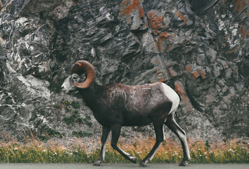
On the drive to the trailhead we saw a bighorn sheep on the side of the road!
Day 1
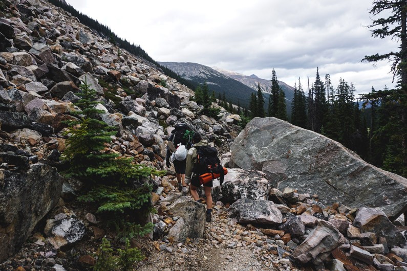
We started at the Portal Creek Trailhead. The climb is very steady throughout the first chunk of the hike approaching Maccarib Pass. We climbed a little over 700m (~2250ft), but over a 15km (~9mi) period. That’s only about 250ft. of elevation of gain a mile, which is nothing. The rest of the hike was practically all downhill after Maccarib Pass.
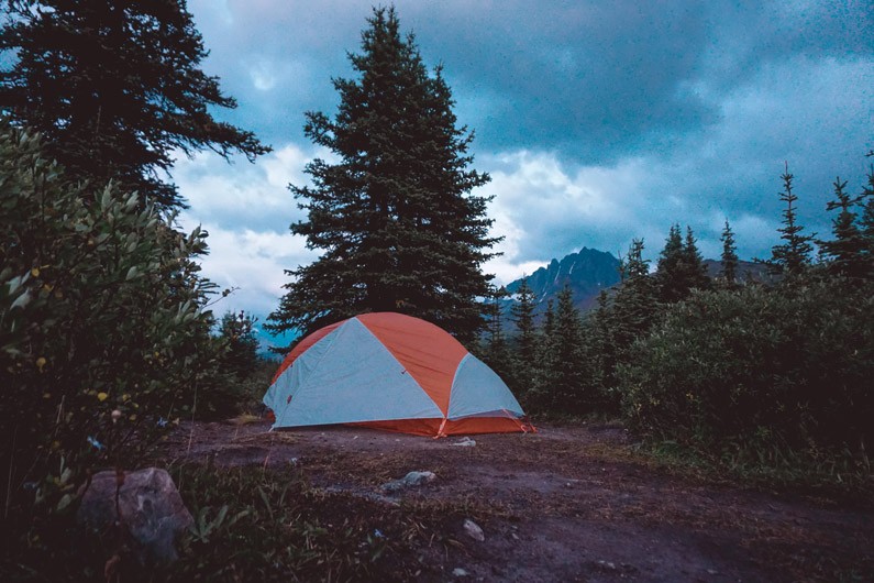
Our campsite for Day 1 was at the Maccarib campsite. We stopped for lunch at the Portal campground, which was nice, but Maccarib was so much better. It’s about 19 km to the Maccarib campsite from the trailhead, but definitely worth the extra push on day one.
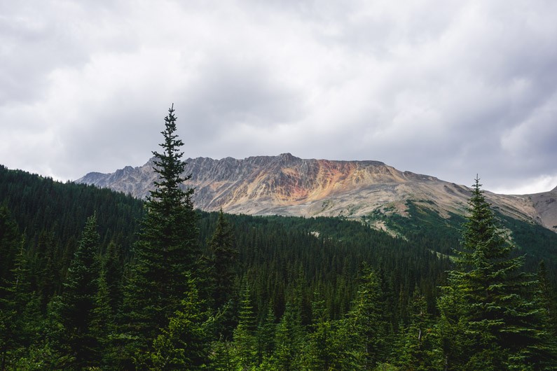
It had been smoky for the past week while we were in Canada due to forest fires in BC, but once we made it to the pass, we were welcomed with majestic views of the valley. This was the first moment of our trip we saw clear mountains without grey haze. It was a beautiful spring-like day and we took some time to soak it all in.
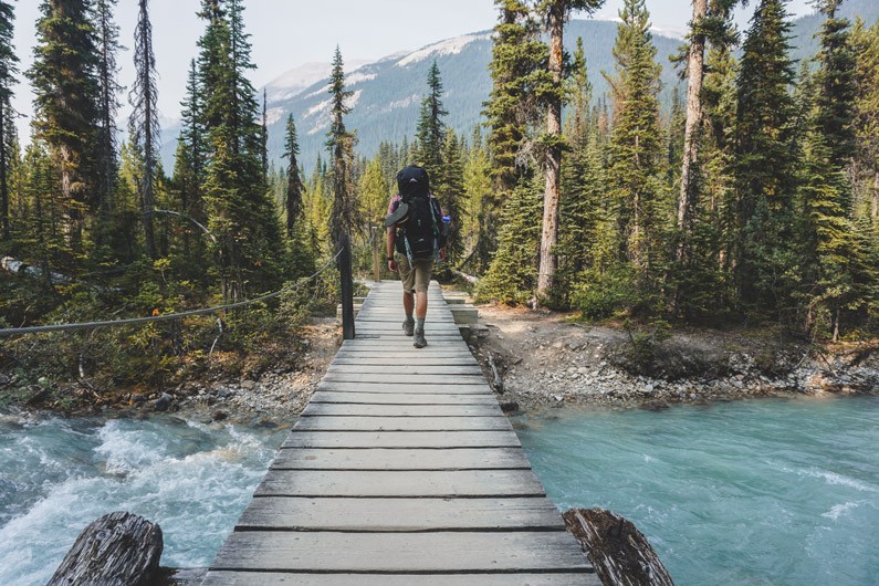
Clouds were starting to cover the tops of the mountains. We could see that is was pouring in the direction of the Maccarib campsite. We were still a few miles away, and the clouds were moving perpendicular to the direction we were hiking, so we decided to sit on a bridge and see if we might be able to dodge the rain.
Speaking of the bridges, I’ve never seen so many bridges in a meadow environment. Jasper takes really great care of their trails and I was happy to not be walking through mush.
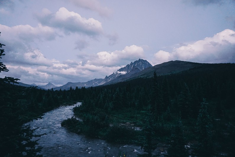
The mountains slowly started to disappear in every direction as the storm rolled in and it began to downpour as temperatures dropped. We threw on our rain gear and decided we might as well push on to the campsite, to try and stay warm by moving.
I don’t think any of us looked around the entire trip to the campsite. All of our heads were down, trying to dodge puddles and keep our faces dry. I didn’t have any rain pants or gaiters, so I got soaked fast. What made my pants and boots so wet was actually plants brushing up on my legs, not the rain. After about an hour and a half we arrived at a raging creek. To our surprise, there were bear poles towering over some trees on the opposite side of the creek. I actually we wished we still had more hiking to do even though we’d already done 12 miles. I didn’t know how we were about to set up tents in this weather.
Step one was to cross the creek.
There was an obvious path on the other side of the creek but the water was too high to cross and stay dry. There was also a path that looked somewhat like a trail off to the left. We took the side trail hoping for a bridge, to no avail. So now we are standing there trying to determine how to cross. There were some rocks about an inch under the flow, all the way across, but one slip and our feet would be soaked. Naomi went first, slipped on step number two, and actually fell into the creek getting her sleeping pad soaked. So now Eric and I were not looking forward to our attempts. I kept my feet dry for a few steps and eventually gave up and trudged through the creek, soaking my boots. Eric followed right behind with the same approach.
All but 2 campsites were taken and everyone had their tents set up and were nice and dry inside. We found a patch of evergreens and huddled underneath to try and get out of the rain. Evergreens actually do a pretty good job at blocking out most of the rain. It was cold and raining, but we decided to hold out under the trees for a little while hoping for the rain to slow.
At this point we’re all shivering and my teeth began to chatter. Standing outside in the cold rain was starting to turn into a dangerous situation and we had to make some survival decisions. I was worried one of us might catch hypothermia and we needed to get dry quick, but it was still raining hard…
This was the worst moment of my life.
I’m not exaggerating. Eric said this was the worst thing he’d ever experienced as well. Naomi got caught in a blizzard on Mount Fuji, so she one upped us and said this was the second worst moment of her life. Looking back, some funny things happened during all of the rain and memories were made but getting caught in freezing rain is definitely something I hope never happens again. Snow would have been so much better.
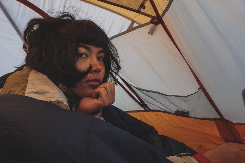
It was pretty hard to think, being so cold, but we managed to come up with a plan to get a tent set up: Naomi and I would hold the rain fly up as wide as we could while Eric assembled his tent underneath. We then grabbed some dry clothes, formed a pile of our soaked clothes under the tent’s vestibule, and the three of us gathered in Eric’s small two-man backpacking tent. It was pretty uncomfortable, and the ground was ice cold, but I was happy to be dry and warming up.
The three of us were in the tent for over 2 hours. A TWO MAN TENT. Eric had one episode of the office saved on his phone, so that passed about 20 mins of time. The rest of the time was spent sitting on each other’s feet, huddling for warmth, complaining, and laughing at how terrible this situation was.
Eventually the rain stopped and it was time to set up my tent. The rain brought in some much cooler temperatures than the nice spring weather we experienced only a few hours ago. Everyone started emerging from their tents and offered their condolences to us having to endure the rain. We also learned that the side trail did actually have a bridge, we just didn’t go far enough… smh.
I guess everyone had better weather apps than me. One couple had a Garmin with satellite weather access and warned us that the new weather prediction called for night temps in the upper 20’s F. Last time I checked it was the mid 40’s… HELLO WINTER. Luckily, we were prepared for cold temps.


Day 2
We awoke to fresh snow on all of the mountains around us. Totally unexpected for the middle of August, but very cool! Our next campsite was only 6 miles away so we took some time to try and dry out our gear before putting everything back in our packs. It hailed/snowed lightly during the early part of our hike.
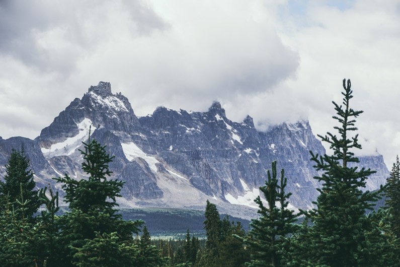
The view around Amethyst Lake was spectacular. This mountain might just be my favourite view from all of my two weeks in Canada:


A photogenic marmot posed for us right off the trail.


We passed a sign that said Switchback Campsite was in 3 km. I was pretty sure the campsite was before the actual switchback started but we never saw a campsite sign so we pushed on.
This is an intense switchback. We were very happy to be going down instead of up, that’s why I recommend starting from the Portal Creek Trailhead like we did.
We were all starting to wonder if we missed our campsite. This was the longest 3km ever, and we were going down, how had we not made it?
Well, eventually we ended up at the Astoria campsite, 3 km had turned into 10. Somehow all three of us missed the Switchback campsite sign? I guess it’s possible, but I have a feeling the sign had fallen down or was missing. We didn’t miss signs for any of the other campsites along the way. So be on the lookout if you’re camping at switchback!
There was only one tent pad left at Astoria when we arrived and we didn’t have a permit for this campsite. We debated staying at Astoria for the night and doubling up our tents on the pad, but it was still pretty early in the evening and we didn’t want to screw over anyone who actually reserved the site. We decided to end the hike early and finished the entire hike around 9pm. (Still before sunset since we’re so far north.)
Unfortunately, we had no place to stay, and lodging is always full in Jasper and the surrounding areas unless you book well in advance. We did find a place to stay, and It was quite an adventure, so I’ll save that story for another post.
In the end, we hiked 15 miles on Day 2. It was tough, but exhilarating, with fantastic views the entire day. Each time we hiked around one mountain, we were rewarded with a whole new view of the Canadian Rockies. If I do this trail again, I’ll definitely go the same direction, but I’ll camp on night 2, like we originally had planned. This is a very doable backpacking route, and non-technical. I’d recommend it to anyone, even first-time backpackers. Just know your limits and take extra time, it’s a long hike.
Let me know if you have any questions and I’d love to hear your experiences from the Tonquin Valley! Drop a comment below.


Helpful Links for Tonquin Valley
Related Blog Posts
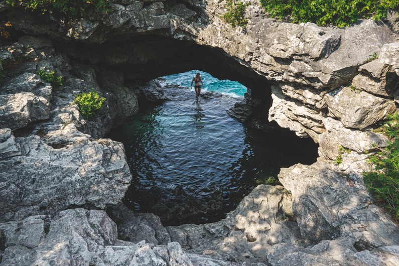
Complete Guide to Backpacking Bruce Peninsula National Park
Backpacking Bruce Peninsula National Park is a unique trek through a beautiful landscape more reminiscent of the Caribbean than Canada. The Bruce Trail features rugged limestone cliffs that plunge dramatically into the crystal-clear Georgian Bay, the famous Grotto,...

A Guide to Backpacking Mount Assiniboine via Sunshine Meadows to Mount Shark
Backpacking Mount Assiniboine Overview: Distance: 37.5 miles (60 km) Elevation Gain: 8146 ft. (2480 m) Time: 4 days Difficulty: Strenuous Many backcountry campsites on this trek require permits/reservations. For Backpacking Mount Assiniboine Provincial Park:...
Yoho National Park Backpacking Loop
Yoho National Park, BC Yoho Valley, Iceline, Whaleback Trails Loop August 12-14, 2017 Overview: Distance: 30km (~19.5mi) Time: 3 days, 2 nights Difficulty: Moderate Elevation Gain: 760m (~2500 ft) I’m writing this post 1.5 years after the fact, but I have...
